
Erie County topographic map
Interactive map
Click on the map to display elevation.
About this map
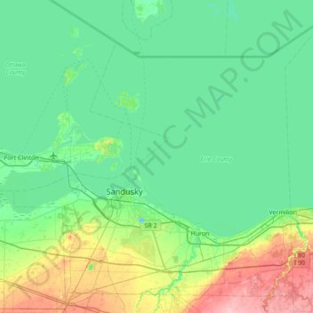
Name: Erie County topographic map, elevation, terrain.
Location: Erie County, Ohio, United States of America (41.28389 -82.95358 41.74148 -82.26895)
Average elevation: 185 m
Minimum elevation: 162 m
Maximum elevation: 276 m
Other topographic maps
Click on a map to view its topography, its elevation and its terrain.
Summit County
United States of America > Ohio
Summit County, Ohio, United States of America
Average elevation: 327 m
Cuyahoga County
United States of America > Ohio
Cuyahoga County, Ohio, United States of America
Average elevation: 211 m