
Janakpur topographic map
Interactive map
Click on the map to display elevation.
About this map
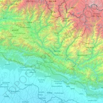
Name: Janakpur topographic map, elevation, terrain.
Location: Janakpur, Central Development Region, Nepal (26.56802 85.32154 28.17381 86.57262)
Average elevation: 1,600 m
Minimum elevation: 57 m
Maximum elevation: 8,165 m
Other topographic maps
Click on a map to view its topography, its elevation and its terrain.
Central Development Region
Nepal > Central Development Region
Central Development Region, Nepal
Average elevation: 1,546 m
Kathmandu
Nepal > Central Development Region > Kathmandu
Kathmandu, Bagmati, Central Development Region, 44600, Nepal
Average elevation: 1,536 m
Chilime Khola
Nepal > Central Development Region
Chilime Khola, Rasuwa, Bagmati, Central Development Region, Nepal
Average elevation: 2,388 m
Bagmati
Nepal > Central Development Region
Bagmati, Central Development Region, Nepal
Average elevation: 2,279 m