
Tshopo topographic map
Interactive map
Click on the map to display elevation.
About this map
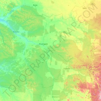
Name: Tshopo topographic map, elevation, terrain.
Location: Tshopo, Democratic Republic of the Congo (-1.98102 22.26073 2.34465 28.18235)
Average elevation: 529 m
Minimum elevation: 344 m
Maximum elevation: 1,432 m
Other topographic maps
Click on a map to view its topography, its elevation and its terrain.
Tshopo
Democratic Republic of the Congo > Tshopo
Tshopo, Democratic Republic of the Congo
Average elevation: 514 m