
Daugavpils topographic map
Interactive map
Click on the map to display elevation.
About this map
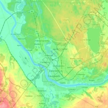
Name: Daugavpils topographic map, elevation, terrain.
Location: Daugavpils, Latgale, Latvia (55.83475 26.43800 55.95759 26.63234)
Average elevation: 109 m
Minimum elevation: 79 m
Maximum elevation: 167 m
Other topographic maps
Click on a map to view its topography, its elevation and its terrain.