
Hwange topographic map
Interactive map
Click on the map to display elevation.
About this map
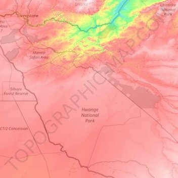
Name: Hwange topographic map, elevation, terrain.
Location: Hwange, Matabeleland North, 00236, Zimbabwe (-19.88950 25.23730 -17.79137 27.75694)
Average elevation: 968 m
Minimum elevation: 479 m
Maximum elevation: 1,334 m
Other topographic maps
Click on a map to view its topography, its elevation and its terrain.
Sengwa River
Sengwa River, Matabeleland North, Zimbabwe
Average elevation: 797 m
Victoria Falls National Park
Zimbabwe > Matabeleland North > Victoria Falls
Victoria Falls National Park, Pioneer Road, Victoria Falls, Hwange, Matabeleland North, 00236, Zimbabwe
Average elevation: 913 m
Katete
Katete, Hwange, Matabeleland North, Zimbabwe
Average elevation: 919 m
Katete
Katete, Hwange, Matabeleland North, Zimbabwe
Average elevation: 950 m