
ледник Конгур topographic map
Interactive map
Click on the map to display elevation.
About this map
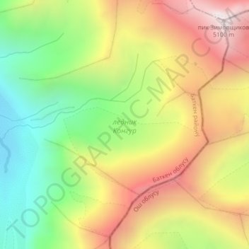
Name: ледник Конгур topographic map, elevation, terrain.
Average elevation: 4,374 m
Minimum elevation: 3,804 m
Maximum elevation: 4,997 m
Other topographic maps
Click on a map to view its topography, its elevation and its terrain.
Alay Mountains
Kyrgyzstan > Batken Region > Баткенский район
Alay Mountains, Баткенский район, Batken Region, Kyrgyzstan
Average elevation: 4,626 m