
Shamva topographic map
Interactive map
Click on the map to display elevation.
About this map
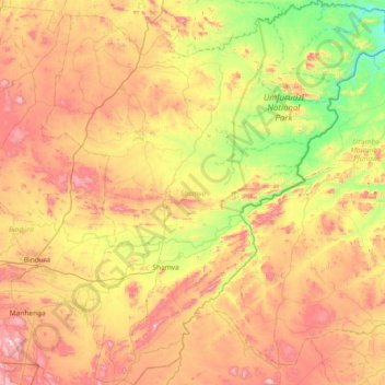
Name: Shamva topographic map, elevation, terrain.
Location: Shamva, Mashonaland Central, Zimbabwe (-17.52982 31.33849 -16.82054 32.00990)
Average elevation: 1,043 m
Minimum elevation: 626 m
Maximum elevation: 1,579 m