
Providence County topographic map
Interactive map
Click on the map to display elevation.
About this map
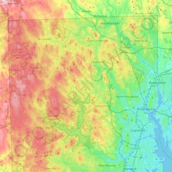
Name: Providence County topographic map, elevation, terrain.
Location: Providence County, Rhode Island, United States of America (41.72452 -71.79925 42.01894 -71.31774)
Average elevation: 108 m
Minimum elevation: -7 m
Maximum elevation: 272 m