
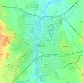
Nantwich topographic map
Interactive map
Click on the map to display elevation.
About this map
Name: Nantwich topographic map, elevation, terrain.
Average elevation: 44 m
Minimum elevation: 31 m
Maximum elevation: 65 m
Other topographic maps
Click on a map to view its topography, its elevation and its terrain.
Nantwich
United Kingdom > England > Nantwich
Nantwich, Cheshire East, North West England, England, CW5 5AU, United Kingdom
Average elevation: 52 m