
Friedrichsfelde topographic map
Interactive map
Click on the map to display elevation.
About this map
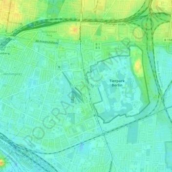
Name: Friedrichsfelde topographic map, elevation, terrain.
Location: Friedrichsfelde, Lichtenberg, Berlin, Germany (52.49096 13.49279 52.51462 13.54173)
Average elevation: 43 m
Minimum elevation: 34 m
Maximum elevation: 59 m
Other topographic maps
Click on a map to view its topography, its elevation and its terrain.