
Le Chenit topographic map
Interactive map
Click on the map to display elevation.
About this map
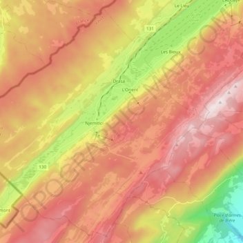
Name: Le Chenit topographic map, elevation, terrain.
Location: Le Chenit, District du Jura-Nord vaudois, Vaud, Switzerland (46.52346 6.11053 46.64508 6.29889)
Average elevation: 1,239 m
Minimum elevation: 661 m
Maximum elevation: 1,676 m