
Saül topographic map
Interactive map
Click on the map to display elevation.
About this map
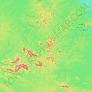
Name: Saül topographic map, elevation, terrain.
Location: Saül, Saint-Laurent-du-Maroni, French Guiana, 97314, France (3.23281 -53.78041 4.40653 -53.09265)
Average elevation: 161 m
Minimum elevation: 17 m
Maximum elevation: 805 m