
Sulaymaniyah topographic map
Interactive map
Click on the map to display elevation.
About this map
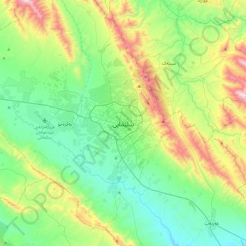
Name: Sulaymaniyah topographic map, elevation, terrain.
Location: Sulaymaniyah, Iraqi Kurdistan, 46001, Iraq (35.39705 45.28260 35.71705 45.60260)
Average elevation: 977 m
Minimum elevation: 591 m
Maximum elevation: 1,972 m