
Hartford County topographic map
Interactive map
Click on the map to display elevation.
About this map
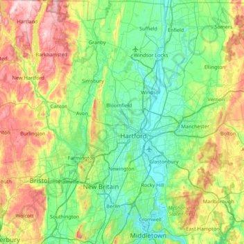
Name: Hartford County topographic map, elevation, terrain.
Location: Hartford County, Connecticut, United States of America (41.54491 -73.02948 42.03878 -72.40801)
Average elevation: 122 m
Minimum elevation: 0 m
Maximum elevation: 430 m