
Carbon County topographic map
Interactive map
Click on the map to display elevation.
About this map
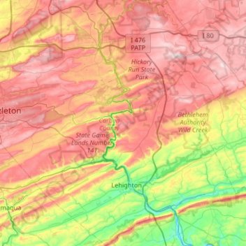
Name: Carbon County topographic map, elevation, terrain.
Location: Carbon County, Pennsylvania, United States (40.73546 -75.99775 41.13386 -75.47446)
Average elevation: 387 m
Minimum elevation: 102 m
Maximum elevation: 668 m
Other topographic maps
Click on a map to view its topography, its elevation and its terrain.
Big Beaver
United States > Pennsylvania > Beaver County
Big Beaver, Beaver County, Pennsylvania, 16141, United States
Average elevation: 324 m
Beaver County
Beaver County, Pennsylvania, United States
Average elevation: 325 m
Mill Hall
United States > Pennsylvania > Mill Hall
Mill Hall, Clinton County, Pennsylvania, United States
Average elevation: 239 m
Bald Eagle
United States > Pennsylvania > Bald Eagle
Bald Eagle, York County, Pennsylvania, 17321, United States
Average elevation: 163 m