
Beaver County topographic map
Interactive map
Click on the map to display elevation.
About this map
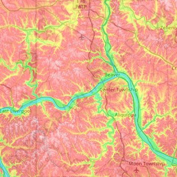
Name: Beaver County topographic map, elevation, terrain.
Location: Beaver County, Pennsylvania, United States (40.47717 -80.51934 40.85414 -80.14483)
Average elevation: 325 m
Minimum elevation: 201 m
Maximum elevation: 414 m
Other topographic maps
Click on a map to view its topography, its elevation and its terrain.
Big Beaver
United States > Pennsylvania > Beaver County
Big Beaver, Beaver County, Pennsylvania, 16141, United States
Average elevation: 324 m
Carbon County
Carbon County, Pennsylvania, United States
Average elevation: 387 m
Mill Hall
United States > Pennsylvania > Mill Hall
Mill Hall, Clinton County, Pennsylvania, United States
Average elevation: 239 m
Bald Eagle
United States > Pennsylvania > Bald Eagle
Bald Eagle, York County, Pennsylvania, 17321, United States
Average elevation: 163 m