
Kings County topographic map
Interactive map
Click on the map to display elevation.
Kings County
Table Mountain is the highest point in Kings County at an elevation of 3,476 feet (1,059 m). It is located in the Diablo Range in southwestern Kings County on the boundary between Kings and Monterey counties.
About this map
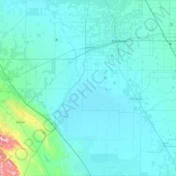
Name: Kings County topographic map, elevation, terrain.
Location: Kings County, California, United States of America (35.78861 -120.31511 36.48883 -119.47438)
Average elevation: 101 m
Minimum elevation: 53 m
Maximum elevation: 828 m
Other topographic maps
Click on a map to view its topography, its elevation and its terrain.