
West Sulawesi topographic map
Interactive map
Click on the map to display elevation.
About this map
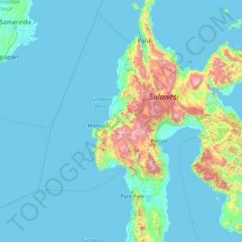
Name: West Sulawesi topographic map, elevation, terrain.
Location: West Sulawesi, Indonesia (-5.05745 116.83190 0.06255 121.95190)
Average elevation: 219 m
Minimum elevation: -3 m
Maximum elevation: 3,181 m