
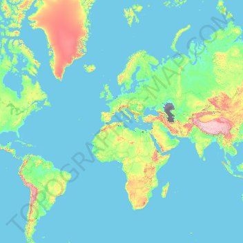
Norway topographic map
Interactive map
Click on the map to display elevation.
About this map
Name: Norway topographic map, elevation, terrain.
Location: Norway (-54.65400 -9.68463 81.02802 34.68891)
Average elevation: 294 m
Minimum elevation: -30 m
Maximum elevation: 7,179 m
Little has been found dating from the early Iron Age (the last 500 years BC). The dead were cremated, and their graves contain few burial goods. During the first four centuries AD, the people of Norway were in contact with Roman-occupied Gaul. About 70 Roman bronze cauldrons, often used as burial urns, have been found. Contact with the civilised countries farther south brought a knowledge of runes; the oldest known Norwegian runic inscription dates from the third century. At this time, the amount of settled area in the country increased, a development that can be traced by coordinated studies of topography, archaeology, and place-names. The oldest root names, such as nes, vik, and bø ("cape," "bay," and "farm"), are of great antiquity, dating perhaps from the Bronze Age, whereas the earliest of the groups of compound names with the suffixes vin ("meadow") or heim ("settlement"), as in Bjǫrgvin (Bergen) or Sǿheim (Seim), usually date from the first century AD.
Other topographic maps
Click on a map to view its topography, its elevation and its terrain.
Saint Croix
United States of America (USVI Saint Croix) > United States Virgin Islands
Saint Croix, Saint Croix District, United States Virgin Islands, United States of America (USVI Saint Croix)
Average elevation: 11 m
Victoria Falls
Zambia > Southern Province > Livingstone
Victoria Falls, Livingstone, Livingstone District, Southern Province, Zambia
Average elevation: 875 m
Tegernsee
Germany > Bavaria > Landkreis Miesbach
Tegernsee, Landkreis Miesbach, Bavaria, 83684, Germany
Average elevation: 858 m
Silver Bay
Canada > Manitoba > Division No. 19 > Unorganized Division No. 19
Silver Bay, Unorganized Division No. 19, Division No. 19, Manitoba, Canada
Average elevation: 248 m
Samfya
Samfya, Samfya District, Luapula Province, Zambia
Average elevation: 1,181 m
Gornji Vakuf-Uskoplje
Bosnia and Herzegovina > Federation of Bosnia and Herzegovina
Gornji Vakuf-Uskoplje, Gornji Vakuf-Uskoplje municipality, Central Bosnia Canton, Federation of Bosnia and Herzegovina, 70240, Bosnia and Herzegovina
Average elevation: 869 m
Oborci
Bosnia and Herzegovina > Federation of Bosnia and Herzegovina
Oborci, Donji Vakuf Municipality, Central Bosnia Canton, Federation of Bosnia and Herzegovina, 70220, Bosnia and Herzegovina
Average elevation: 807 m
Donji Vakuf
Bosnia and Herzegovina > Federation of Bosnia and Herzegovina
Donji Vakuf, Donji Vakuf Municipality, Central Bosnia Canton, Federation of Bosnia and Herzegovina, 70220, Bosnia and Herzegovina
Average elevation: 694 m
Beer Lake
Canada > Ontario > Haliburton County > Minden Hills
Beer Lake, Minden Hills, Haliburton County, Central Ontario, Ontario, Canada
Average elevation: 341 m
Silver Bay
United States > Minnesota > Lake County
Silver Bay, Lake County, Minnesota, United States
Average elevation: 247 m
Walkersville
United States > Maryland > Frederick County
Walkersville, Frederick County, Maryland, 21793, United States
Average elevation: 99 m
Al Azhar Park
Al Azhar Park, El-Darb El-Ahmar, Cairo, Egypt
Average elevation: 53 m
Rangiroa
France > French Polynesia > Rangiroa
Rangiroa, Tuamotu-Gambier, French Polynesia, 98775, France
Average elevation: 0 m
Royal Borough of Greenwich
United Kingdom > England > London
Royal Borough of Greenwich, London, Greater London, England, United Kingdom
Average elevation: 32 m
Gwembe
Gwembe, Gwembe District, Southern Province, Zambia
Average elevation: 1,182 m
Niseko
Niseko, Abuta County, Shiribeshi Subprefecture, Hokkaido Prefecture, Japan
Average elevation: 339 m
Hawthorne
United States > Florida > Lee County > Bonita Springs
Hawthorne, Bonita Springs, Lee County, Florida, 34135, United States
Average elevation: 5 m
Big Beaver
United States > Pennsylvania > Beaver County
Big Beaver, Beaver County, Pennsylvania, 16141, United States
Average elevation: 324 m
Kondoa
Kondoa, Kondoa Town, Dodoma Region, Central Zone, Tanzania
Average elevation: 1,386 m
Burke
United States > Virginia > Fairfax County
Burke, Fairfax County, Virginia, 22015, United States
Average elevation: 97 m
Dodoma
Dodoma, Dodoma City, Dodoma Region, Central Zone, Tanzania
Average elevation: 1,144 m
Kazungula District
Kazungula District, Southern Province, Zambia
Average elevation: 1,069 m
Los Altos Hills
United States > California > Santa Clara County
Los Altos Hills, Santa Clara County, California, United States
Average elevation: 146 m
Kasenseli Village
Zambia > North-Western Province
Kasenseli Village, Mwinilunga District, North-Western Province, Zambia
Average elevation: 1,437 m
Kanjimana
Zambia > North-Western Province
Kanjimana, Ikelenge District, North-Western Province, Zambia
Average elevation: 1,279 m
Falaj
Oman > Muscat Governorate > Muscat
Falaj, Muscat, Muscat Governorate, 112, Oman
Average elevation: 194 m
Rufunsa District
Rufunsa District, Lusaka Province, Zambia
Average elevation: 796 m
Al Balid
Oman > Dhofar Governorate > Salalah
Al Balid, Salalah, Dhofar Governorate, 216, Oman
Average elevation: 4 m
Rattan
United States > Oklahoma > Pushmataha County
Rattan, Pushmataha County, Oklahoma, 74562, United States
Average elevation: 153 m
Tullaghan
Tullaghan, County Leitrim, Connacht, Ireland
Average elevation: 12 m
Newell Station
United States > Tennessee > Sevier County
Newell Station, Seymour, Sevier County, East Tennessee, Tennessee, 37865, United States
Average elevation: 323 m
Darwin
Ecuador > Galápagos > Cantón Isabela
Darwin, Parroquia Tomás de Berlanga (Santo Tomás), Cantón Isabela, Galápagos, Ecuador
Average elevation: 5 m