
Hunedoara topographic map
Interactive map
Click on the map to display elevation.
About this map
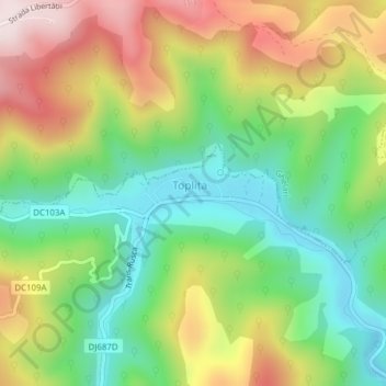
Name: Hunedoara topographic map, elevation, terrain.
Location: Toplița, Hunedoara, 337480, Romania (45.68472 22.77660 45.68903 22.79536)
Average elevation: 518 m
Minimum elevation: 307 m
Maximum elevation: 814 m
Other topographic maps
Click on a map to view its topography, its elevation and its terrain.
Transylvania
Transylvania, Band, Mureș, 547065, Romania
Average elevation: 648 m
Danube Delta Biosphere Reserve
Danube Delta Biosphere Reserve, Tulcea, 827051, Romania
Average elevation: 3 m