
Estuaire topographic map
Interactive map
Click on the map to display elevation.
About this map
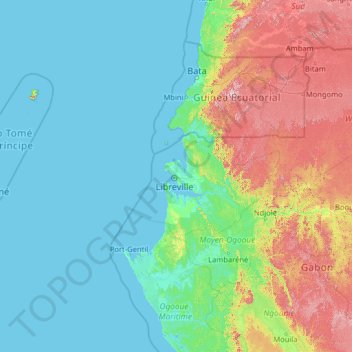
Name: Estuaire topographic map, elevation, terrain.
Location: Estuaire, Gabon (-2.12974 6.90552 2.99026 12.02552)
Average elevation: 174 m
Minimum elevation: -1 m
Maximum elevation: 1,162 m
Other topographic maps
Click on a map to view its topography, its elevation and its terrain.