
Lunga River topographic map
Interactive map
Click on the map to display elevation.
About this map
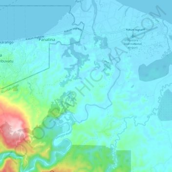
Name: Lunga River topographic map, elevation, terrain.
Location: Lunga River, Guadalcanal Province, Solomon Islands (-9.50442 159.98751 -9.40969 160.04360)
Average elevation: 49 m
Minimum elevation: -3 m
Maximum elevation: 386 m
Other topographic maps
Click on a map to view its topography, its elevation and its terrain.
Guadalcanal Island
Solomon Islands > Guadalcanal Province > Aola
Guadalcanal Island, Aola, Guadalcanal Province, Solomon Islands
Average elevation: 118 m