
Kasai topographic map
Interactive map
Click on the map to display elevation.
About this map
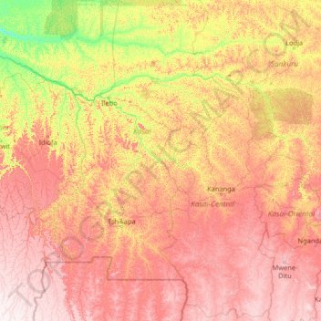
Name: Kasai topographic map, elevation, terrain.
Location: Kasai, Democratic Republic of the Congo (-7.94980 18.82410 -2.74980 24.02410)
Average elevation: 609 m
Minimum elevation: 305 m
Maximum elevation: 1,143 m
Other topographic maps
Click on a map to view its topography, its elevation and its terrain.