
Falls Creek topographic map
Interactive map
Click on the map to display elevation.
About this map
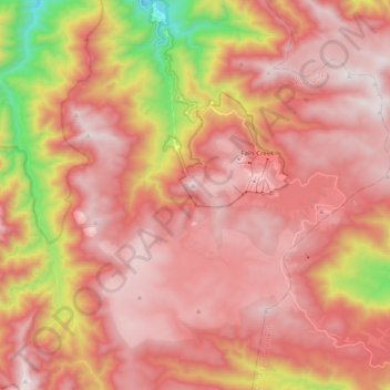
Name: Falls Creek topographic map, elevation, terrain.
Location: Falls Creek, Victoria, 3699, Australia (-36.94013 147.14335 -36.81784 147.34558)
Average elevation: 1,459 m
Minimum elevation: 629 m
Maximum elevation: 1,892 m
The Falls Creek Alpine Resort is an alpine ski resort in the Hume region in northeastern Victoria, Australia. It is located in the Alpine National Park in the Victorian Alps, approximately 350 kilometres (220 miles) by road from Melbourne, with the nearest town being Mount Beauty, which is approximately 30 km (20 mi) away. The resort lies between an elevation of 1,210 and 1,830 m (3,970 and 6,004 ft) above sea level, with the highest lifted point at 1,780 m (5,840 ft). Skiing is possible on the nearby peak of Mount McKay at 1,842 m (6,043 ft), accessed by snowcat from the resort.
Other topographic maps
Click on a map to view its topography, its elevation and its terrain.
Beechworth
Australia > Victoria > Beechworth
Beechworth, Shire of Indigo, Hume, Victoria, 3747, Australia
Average elevation: 533 m
Basalt Lake
Australia > Victoria > Harkaway
Basalt Lake, Board Walk, Berwick, Harkaway, City of Casey, Victoria, 3806, Australia
Average elevation: 76 m
Mount Dawson
Mount Dawson, Shire of East Gippsland, Gippsland, Victoria, Australia
Average elevation: 435 m
Croajingolong National Park
Croajingolong National Park, Lake Barracotta Link Track, Genoa, Shire of East Gippsland, Gippsland, Victoria, Australia
Average elevation: 50 m
Wilsons Promontory
Wilsons Promontory, Shire of South Gippsland, Gippsland, Victoria, Australia
Average elevation: 28 m
Wingan River
Wingan River, Shire of East Gippsland, Gippsland, Victoria, Australia
Average elevation: 131 m
Mount Feathertop
Mount Feathertop, Alpine Shire, Hume, Victoria, Australia
Average elevation: 1,533 m
Mount Fraser
Mount Fraser, Shire of Mitchell, Hume, Victoria, 3753, Australia
Average elevation: 309 m
Hattah - Kulkyne National Park
Australia > Victoria > Colignan
Hattah - Kulkyne National Park, Reed Road, Hattah, Colignan, Rural City of Mildura, Loddon Mallee, Victoria, Australia
Average elevation: 51 m
Badger Creek
Australia > Victoria > Healesville
Badger Creek, Healesville, Shire of Yarra Ranges, Victoria, Australia
Average elevation: 255 m
Wilsons Promontory National Park
Wilsons Promontory National Park, Vereker Outlook, Wilsons Promontory, Shire of South Gippsland, Gippsland, Victoria, Australia
Average elevation: 32 m