
Doña Ana County topographic map
Interactive map
Click on the map to display elevation.
About this map
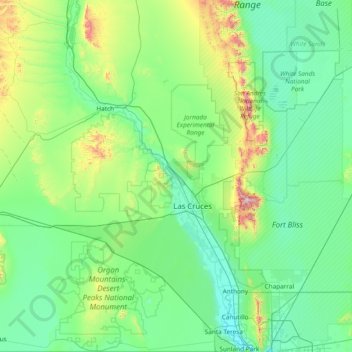
Name: Doña Ana County topographic map, elevation, terrain.
Location: Doña Ana County, New Mexico, United States of America (31.78351 -107.29971 33.05281 -106.34051)
Average elevation: 1,349 m
Minimum elevation: 1,137 m
Maximum elevation: 2,696 m