
Passaic County topographic map
Interactive map
Click on the map to display elevation.
About this map
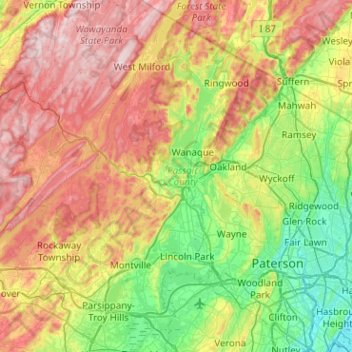
Name: Passaic County topographic map, elevation, terrain.
Location: Passaic County, New Jersey, United States of America (40.81993 -74.50288 41.20289 -74.10679)
Average elevation: 182 m
Minimum elevation: 0 m
Maximum elevation: 451 m
The highest point is any one of six areas on Bearfort Ridge in West Milford at approximately 1,480 feet (450 m) above sea level. The lowest elevation is approximately 20 feet (6.1 m) along the Passaic River in Clifton.
Other topographic maps
Click on a map to view its topography, its elevation and its terrain.
Atlantic County
United States of America > New Jersey
Atlantic County, New Jersey, United States of America
Average elevation: 15 m
Ocean County
United States of America > New Jersey
Ocean County, New Jersey, United States of America
Average elevation: 15 m