
Thank you for supporting this site ❤️
Make a donation
Make a donation
Cheshire County topographic map
Click on the map to display elevation.
Thank you for supporting this site ❤️
Make a donation
Make a donation
About this map
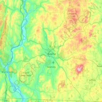
Name: Cheshire County topographic map, elevation, terrain.
Location: Cheshire County, New Hampshire, United States of America (42.71216 -72.55724 43.18196 -71.92886)
Average elevation: 308 m
Minimum elevation: 54 m
Maximum elevation: 944 m
Thank you for supporting this site ❤️
Make a donation
Make a donation