
Bihor topographic map
Interactive map
Click on the map to display elevation.
About this map
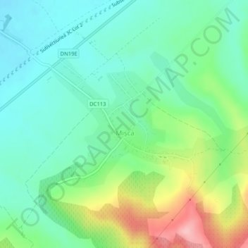
Name: Bihor topographic map, elevation, terrain.
Location: Mișca, Bihor, 417183, Romania (47.25508 22.24541 47.27219 22.27161)
Average elevation: 170 m
Minimum elevation: 124 m
Maximum elevation: 275 m
Other topographic maps
Click on a map to view its topography, its elevation and its terrain.
Transylvania
Transylvania, Band, Mureș, 547065, Romania
Average elevation: 648 m
Danube Delta Biosphere Reserve
Danube Delta Biosphere Reserve, Tulcea, 827051, Romania
Average elevation: 3 m