
Deschutes County topographic map
Interactive map
Click on the map to display elevation.
About this map
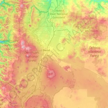
Name: Deschutes County topographic map, elevation, terrain.
Location: Deschutes County, Oregon, United States of America (43.61106 -122.00251 44.39352 -119.89658)
Average elevation: 1,324 m
Minimum elevation: 423 m
Maximum elevation: 3,082 m
Other topographic maps
Click on a map to view its topography, its elevation and its terrain.
Clackamas County
United States of America > Oregon
Clackamas County, Oregon, United States of America
Average elevation: 660 m
Tillamook County
United States of America > Oregon
Tillamook County, Oregon, United States of America
Average elevation: 236 m
Multnomah County
United States of America > Oregon
Multnomah County, Oregon, United States of America
Average elevation: 334 m
Coos County
United States of America > Oregon
Coos County, Oregon, United States of America
Average elevation: 266 m