
Mangochi topographic map
Interactive map
Click on the map to display elevation.
About this map
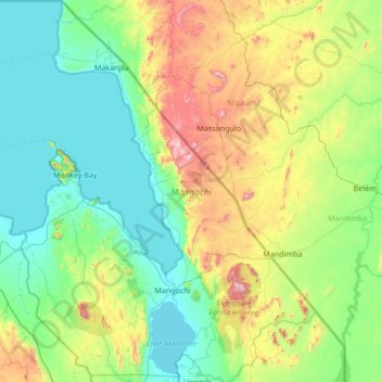
Name: Mangochi topographic map, elevation, terrain.
Location: Mangochi, Southern Region, Malawi (-14.79809 34.72222 -13.48311 35.76961)
Average elevation: 726 m
Minimum elevation: 472 m
Maximum elevation: 1,710 m