
Vân Đồn District topographic map
Interactive map
Click on the map to display elevation.
About this map
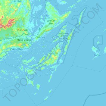
Name: Vân Đồn District topographic map, elevation, terrain.
Location: Vân Đồn District, Quang Ninh Province, 20000, Vietnam (20.70623 107.27479 21.28691 107.81304)
Average elevation: 24 m
Minimum elevation: -4 m
Maximum elevation: 848 m