
Torngat Mountains National Park topographic map
Interactive map
Click on the map to display elevation.
About this map
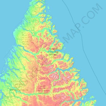
Name: Torngat Mountains National Park topographic map, elevation, terrain.
Average elevation: 214 m
Minimum elevation: -2 m
Maximum elevation: 1,547 m
Other topographic maps
Click on a map to view its topography, its elevation and its terrain.
Labrador
Canada > Newfoundland and Labrador
Labrador, Newfoundland and Labrador, Canada
Average elevation: 238 m
Long Range Mountains
Canada > Newfoundland and Labrador
Long Range Mountains, Newfoundland and Labrador, Canada
Average elevation: 557 m