
Baraga County topographic map
Interactive map
Click on the map to display elevation.
About this map
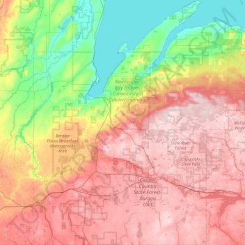
Name: Baraga County topographic map, elevation, terrain.
Location: Baraga County, Michigan, USA (46.41890 -88.68200 46.96711 -87.99176)
Average elevation: 379 m
Minimum elevation: 175 m
Maximum elevation: 598 m
Other topographic maps
Click on a map to view its topography, its elevation and its terrain.
Poseyville
USA > Michigan > Poseyville
Poseyville, Midland County, Michigan, USA
Average elevation: 195 m