
Balearic Islands topographic map
Interactive map
Click on the map to display elevation.
About this map
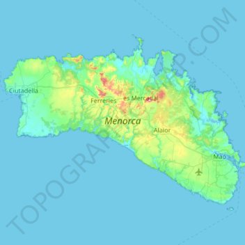
Name: Balearic Islands topographic map, elevation, terrain.
Location: Menorca, Balearic Islands, Spain (39.79915 3.79085 40.09459 4.32793)
Average elevation: 22 m
Minimum elevation: -2 m
Maximum elevation: 337 m
Other topographic maps
Click on a map to view its topography, its elevation and its terrain.