
Coos County topographic map
Interactive map
Click on the map to display elevation.
About this map
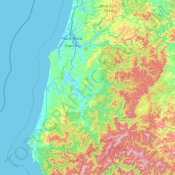
Name: Coos County topographic map, elevation, terrain.
Location: Coos County, Oregon, United States of America (42.66638 -124.55228 43.61145 -123.70156)
Average elevation: 266 m
Minimum elevation: -3 m
Maximum elevation: 1,257 m
Other topographic maps
Click on a map to view its topography, its elevation and its terrain.
Clackamas County
United States of America > Oregon
Clackamas County, Oregon, United States of America
Average elevation: 660 m
Tillamook County
United States of America > Oregon
Tillamook County, Oregon, United States of America
Average elevation: 236 m
Multnomah County
United States of America > Oregon
Multnomah County, Oregon, United States of America
Average elevation: 334 m
Deschutes County
United States of America > Oregon
Deschutes County, Oregon, United States of America
Average elevation: 1,324 m