Castelló de la Plana topographic map
Interactive map
Click on the map to display elevation.
About this map
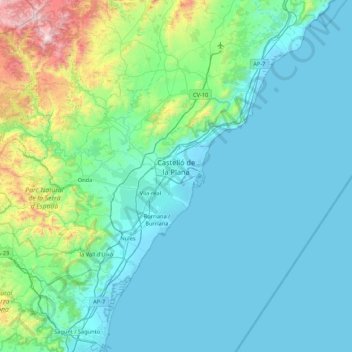
Name: Castelló de la Plana topographic map, elevation, terrain.
Average elevation: 216 m
Minimum elevation: -3 m
Maximum elevation: 1,730 m

Click on the map to display elevation.
Name: Castelló de la Plana topographic map, elevation, terrain.
Average elevation: 216 m
Minimum elevation: -3 m
Maximum elevation: 1,730 m