
Make a donation
Denver topographic map
Click on the map to display elevation.
Make a donation
Denver
Denver's downtown district lies about 12 miles (19 kilometers) east of the foothills of the Rocky Mountains. Named after James W. Denver, the governor of the Kansas Territory at the time, Denver was founded at the confluence of Cherry Creek and the South Platte River in 1858 during the Gold Rush era. Nicknamed the "Mile High City" because its official elevation is exactly one mile (5280 feet or 1609.344 meters) above sea level, Denver grew beyond its prospecting origins to become the principal commercial and transportation hub for a broad region spanning the Great Plains and Rocky Mountain West. The 105th meridian west of Greenwich, the longitudinal reference for the Mountain Time Zone, passes directly through Denver Union Station.
Make a donation
About this map
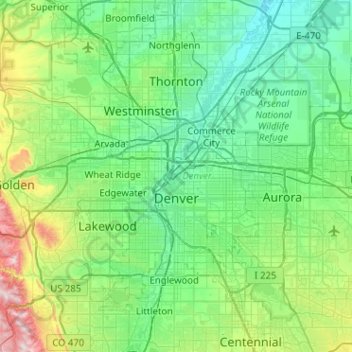
Name: Denver topographic map, elevation, terrain.
Location: Denver, Colorado, United States (39.61430 -105.10988 39.91421 -104.59970)
Average elevation: 1,684 m
Minimum elevation: 1,515 m
Maximum elevation: 2,397 m
Make a donation