
Thank you for supporting this site ❤️
Make a donation
Make a donation
Middle Franconia topographic map
Click on the map to display elevation.
Thank you for supporting this site ❤️
Make a donation
Make a donation
About this map
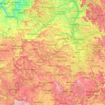
Name: Middle Franconia topographic map, elevation, terrain.
Location: Middle Franconia, Bavaria, Germany (48.85834 10.06955 49.78825 11.60163)
Average elevation: 413 m
Minimum elevation: 174 m
Maximum elevation: 731 m
Thank you for supporting this site ❤️
Make a donation
Make a donation
Other topographic maps
Click on a map to view its topography, its elevation and its terrain.
Allgäu
The alpine regions of the Allgäu rise over 2,000 metres in elevation and are popular for winter skiing. The Allgovian area is notable for its beautiful landscapes and is popular for vacations and therapeutic stays. It is well known in Germany for its farm produce, especially dairy products including…
Average elevation: 1,087 m