
Thank you for supporting this site ❤️
Make a donation
Make a donation
Larimer County topographic map
Click on the map to display elevation.
Thank you for supporting this site ❤️
Make a donation
Make a donation
About this map
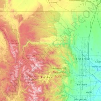
Name: Larimer County topographic map, elevation, terrain.
Location: Larimer County, Colorado, United States (40.25817 -106.19544 40.99824 -104.94190)
Average elevation: 2,363 m
Minimum elevation: 1,442 m
Maximum elevation: 4,281 m
Thank you for supporting this site ❤️
Make a donation
Make a donation