
Thank you for supporting this site ❤️
Make a donation
Make a donation
Sangrur District topographic map
Click on the map to display elevation.
Thank you for supporting this site ❤️
Make a donation
Make a donation
About this map
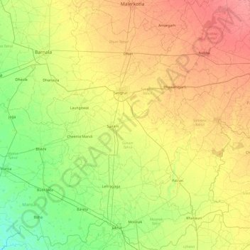
Name: Sangrur District topographic map, elevation, terrain.
Location: Sangrur District, Punjab, India (29.72672 75.55559 30.54484 76.20386)
Average elevation: 234 m
Minimum elevation: 211 m
Maximum elevation: 264 m
Thank you for supporting this site ❤️
Make a donation
Make a donation