
Newbury topographic map
Interactive map
Click on the map to display elevation.
About this map
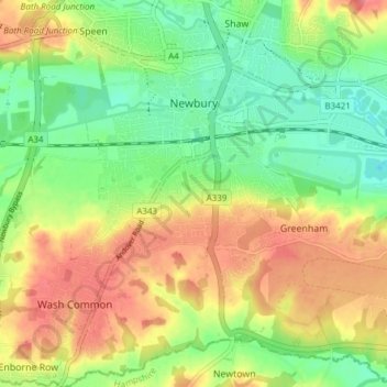
Name: Newbury topographic map, elevation, terrain.
Location: Newbury, West Berkshire, South East, England, United Kingdom (51.36711 -1.35315 51.41456 -1.28819)
Average elevation: 98 m
Minimum elevation: 68 m
Maximum elevation: 135 m
Other topographic maps
Click on a map to view its topography, its elevation and its terrain.
Newbury
United Kingdom > England > Newbury
Newbury, West Berkshire, South East, England, RG14 1DJ, United Kingdom
Average elevation: 102 m